How to define a coordinate system for a vector or raster file in ArcGIS 10.X
This tutorial is valuable for every kind of Geographic data (Vector and Raster Data). It is different from the tool project (for vector data) and project raster (for raster data).
This tool could be used if you have geographic
data with undefined coordinate system or bad defined coordinate system.
Step 1: Open Arcmap
Step 2: Open your data using the Add data
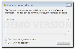
You will get the next warning message,
because the coordinate system of your data is not defined
Step 3: click OK
Step 4: click on search window tool
Step 4: write define projection
Step 5: Click on Define Projection (Data Management Tool)
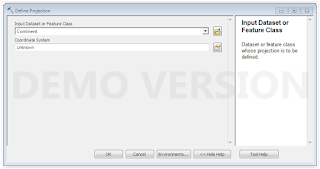
A new window will appear
Step 6: Select your data with unknown
coordinate system as Input Dataset and choose the appropriate coordinate
system in the Coordinate System Tab
Step 7: Click OK


the best text editor which i was using is notepad++ mac Download
ReplyDelete